
Family Maps of Brown County, Indiana, Deluxe Edition
No Customer Reviews

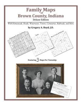
Locating original landowners in maps has never been an easy task-until now. This volume in the Family Maps series contains newly created maps of original landowners (patent maps) in what is now Brown County, Indiana, gleaned from the indexes of the U.S. Bureau of Land Management. But it offers much more than that. For each township in the county, there are two additional maps accompanying the patent map: a road map and a map showing waterways, railroads, and both modern and many historical city-centers and cemeteries. Included are indexes to help you locate what you are looking for, whether you know a person's name, a last name, a place-name, or a cemetery. The combination of maps and indexes are designed to aid researchers of American history or genealogy to explore frontier neighborhoods, examine family migrations, locate hard-to-find cemeteries and towns, as well as locate land based on legal descriptions found in old documents or deeds. The patent-maps are essentially plat maps but instead of depicting owners for a particular year, these maps show original landowners, no matter when the transfer from the federal government was completed. Dates of patents typically begin near the time of statehood and run into the early 1900s. Here are the counts for parcels of land mapped, by the decade in which the corresponding land patents were issued: DecadeParcel-count 1820s14 1830s460 1840s922 1850s961 1860s15 1870s9 1900s1 1910s4 What Cities and Towns are in Brown County, Indiana (and in this book)? Annandale Estates, Beanblossom, Bear Wallow, Becks Grove, Belmont, Buffalo, Camp Roberts, Christiansburg, Clarksdale, Cornelius, Elkinsville, Fruitdale, Gatesville, Gnaw Bone, Helmsburg, Lake on the Green, Lanam, Mount Liberty, Nashville, Needmore, Pikes Peak, Point Idalawn, Spearsville, Spurgeons Corner, Stone Head, Story, Sweetwater Lake, Taggart, Town Hill, Trevlac, Waycross, West Overlook, Young What's Mapped in this book (that you'll not likely find elsewhere) . . . 2386 Parcels of Land (with original landowner names and patent-dates labeled in the relevant map) 24 Cemeteries plus . . . Roads, and existing Rivers, Creeks, Streams, Railroads, and Small-towns (including some historical), etc.
Format:Paperback
Language:English
ISBN:1420314548
ISBN13:9781420314540
Release Date:July 2010
Publisher:Arphax Publishing Co.
Length:186 Pages
Weight:0.98 lbs.
Dimensions:0.4" x 8.5" x 11.0"
Related Subjects
ReferenceCustomer Reviews
0 rating
Copyright © 2025 Thriftbooks.com
Terms of Use | Privacy Policy | Do Not Sell/Share My Personal Information | Cookie Policy | Cookie Preferences | Accessibility Statement
ThriftBooks ® and the ThriftBooks ® logo are registered trademarks of Thrift Books Global, LLC
ThriftBooks ® and the ThriftBooks ® logo are registered trademarks of Thrift Books Global, LLC
